Land’s-End Eye to Sacrality
By Michael H. Kew

Sometimes through clear air within 200 miles of California’s Vandenberg Air Force Base (“Welcome to Space Country”) we can see the marvel of rocketry as it spears the sky, a white-hot ferocity crossing half the Pacific in a half-hour.
One bright breezy pre-9/11 day with a bag and board, I’d left Jalama Road to bicycle seven miles northwest, tracing the prairied curve of Jalama Bay upon weedy, gravelly Southern Pacific track. Aiming for a day or two of surf and solitude, I first spent a Moonless night on Vandenberg’s south fringe.
Near 1 a.m., cold and tentless, I rubbed my eyes amid rotting kelp at the foot of a low sandstone bluff. I’d been stirred by the muted (like wearing earplugs) rumble of an unarmed intercontinental ballistic test missile that had been spit from an underground silo near Point Sal, 21 miles north, the propellant an aural oddity over the crack of south-swell shorebreak 10 yards from my toes. Coyotes howled at the shrinking fireball as it sped west to Kwajalein Atoll, where it would plunge, 4,200 miles from me, fulfilling its journey across the starry-black canvas of stratosphere.
Ten miles opposite, at the bay’s south tip, for hours there’d been another flare, this one intimate and solacious. Point Conception, aka Humqaq, a burr on California’s hip, had shone a tiny white dot, an atmospheric—and metaphoric—oblation to ocean. Like the Point Sal silos, Humqaq was a springboard. It was (and is) the “western gate” per its legends and spirit flights to infinitude, anciently revered in the nearby Chumash villages of ‘Upop and Shilimazshtush. For the Chumash, Humqaq was a southwest-pointing land’s-end eye to sacrality, a portal for the hereafter, for glowing eternity, a rainbow bridge—not a divide—to Shimilaqsha: realm of the dead. The point hosted a great shawil (feathered pole shrine), used on the winter solstice, when an antap (shamanic priest) led mourning ceremonies and honored the Sun.
Silently from my sleeping bag I honored the lighthouse. Flashing every 30 seconds, the dot was said to be seen by sailors 20 miles out. For them, it was a wan lure toward the soothful south, the crowded comfort of culture, to many ports, to softer seas. I was on the other side, just, but the aura was palpable. A kinder, gentler coast? Just turn the corner. Many of us have. Conversely, I know lifelong southern California surfers who’ve yet to breach holy Humqaq.
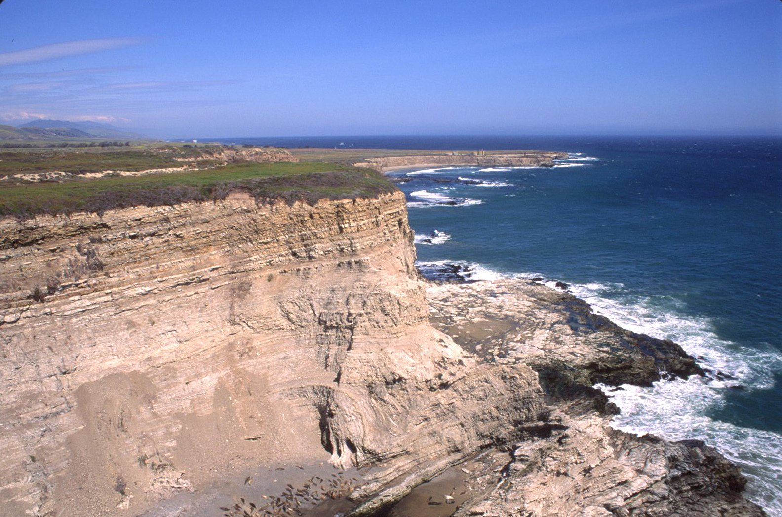
Two eves later, after I’d flipped course (a pit stop at Jalama Beach—equidistant from my two reefy destinations—was followed by a southeasterly bike slog), the swell had waned but remained and again I was supine, this time on a sandy beach in Cojo Bay, just east of Humqaq. Much closer to its winking dot and railroading at dusk, timing my trespass into Cojo Ranch, I detoured to glimpse the iconic lighthouse and the hunchbacked treeless tongue of ruddy ice plant and beige sandstone, its three sheer sides ribbed from wind, waves, and eons of erosion.
Humqaq pokes the Santa Barbara Channel atop the Southern California Bight, a 350-mile-long anomaly in the West Coast’s general orientation. A broad inversion, a retreat from the non-pacific Pacific, the Bight is a dynamic web of currents, seeding one of Earth’s most diverse marine environs. Currents flow north and south, paralleling the coast at various depths and in opposite directions. Humqaq is where these currents—and our cultures—collide.
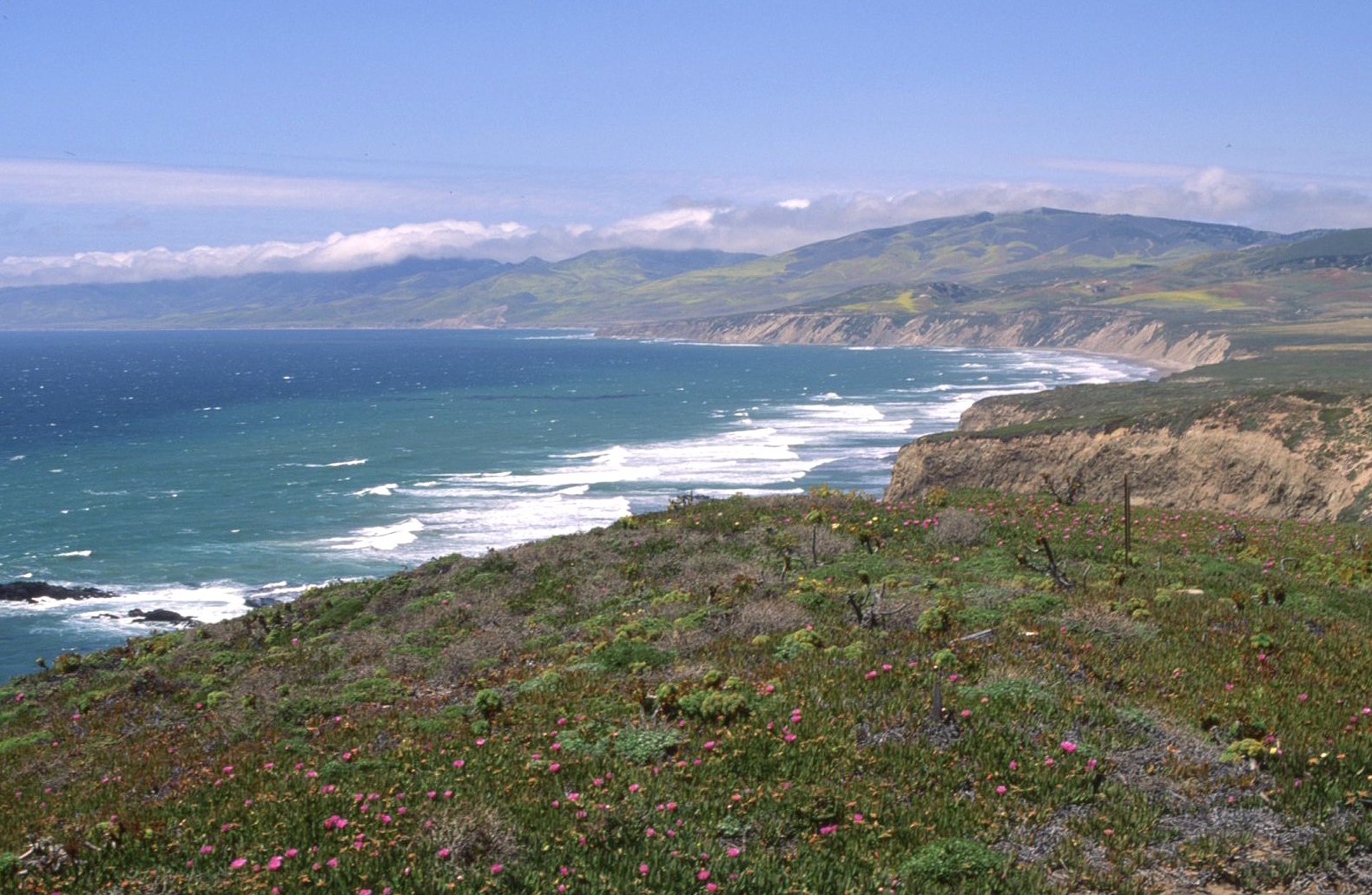
The Bight, hosting five surfy counties and a piece of north Baja, cups the eight Channel Islands, the cuatro Islas Coronado, the dos Islas de Todos Santos, and thousands of surfers from Gaviota to Cabo Banda. Geographically the southern fringe of California’s central coast, which runs to San Francisco, Humqaq marks a radical, 90-degree shift pelagically, climatically, and ecologically, shearing the warmer, densely populated Bight beaches from colder, more turbulent, far wilder shores. Santa Barbara County’s coast, which Humqaq cleaves, could be deemed yin (north—darkness, passivity) and yang (south—light, activity).
But this would be wrong.
Humqaq’s backyard is a bucolia that on 2017’s winter solstice—ironically, as mentioned, sacred for the Chumash—was sealed via two septuagenarian techpreneurs who gave US$165 million to the Nature Conservancy so it could buy the Cojo-Jalama ranches. Now the Jack and Laura Dangermond Preserve, it is a biodiverse permanence—1,400 plant and animal species; 60 rare, 24 endangered. And, like Camp Pendleton, a precious view of pre-sprawl Bight: coastal live oak, wooded canyons, creeks, mountains, sunny prairies, cattle, abundant wildlife, and reefs that sometimes spark. Hence my trespass up the tracks into Vandenberg and down the tracks into Jalama-Cojo, the latter for decades fiercely private acreage prone to concrete (including a spaceport and a liquefied natural gas terminal).
Today the Chumash soul breathes easy.
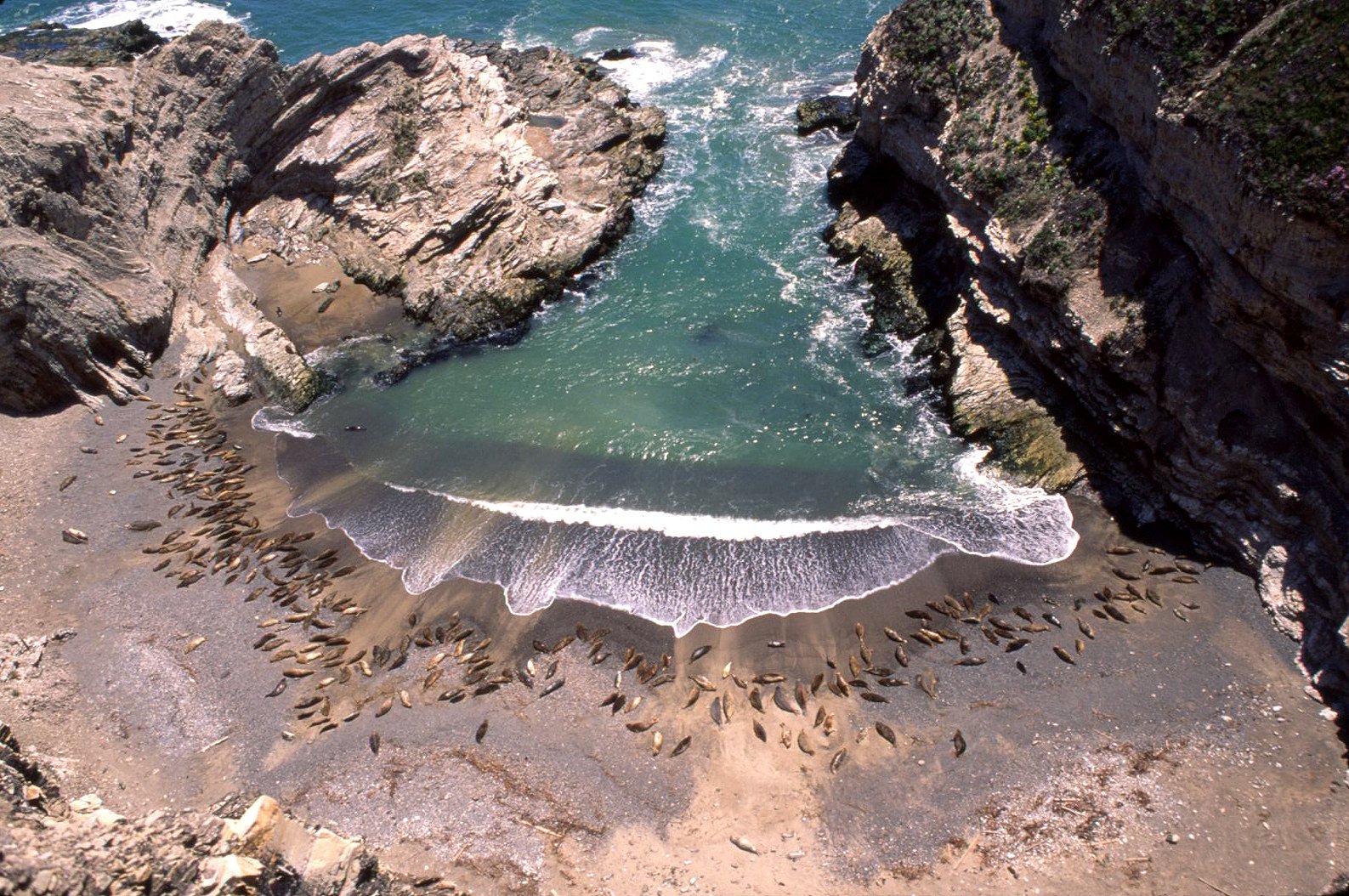
The Nature Conservancy manages these 24,000 acres of idyll, including eight miles of beach where I’d makeshift-camped, Humqaq-focused, point-pondering. (Fifteen years later, the reef I’d surfed became part of the 22-square-mile Point Conception State Marine Reserve.) Bids to pass the point are often delayed or denied. In October 1542, Humqaq was dubbed Cabo de Galera (“Galley Cape”) by Juan Rodríguez Cabrillo, the ambitious Portuguese/Spanish conquistador, one of the first Euros to chart Alta Cal’s coast. For a month, he was unable to round storm-lashed Galera, its name on Spanish charts until 1602, when Spaniard Sebastián Vizcaíno sailed past and renamed it Punta de la Limpia Concepción (“Point of the Immaculate Conception”) for that day’s Feast of the Immaculate (per the Virgin Mary) that still occurs each December 8.
Point Conception: a divide. Saved.
Humqaq: a bridge. Salvation.
[Originally published in Kelp Journal]
[Main photograph by Chris Burkard]
Photograph by Gary Lynch

Lynch
Lynch

Kew
Lynch

Nick Bobroff